World Maps
World Maps can be represented in a variety of ways as shown below.
Generally the region which is in the centre will be displayed based on your location. For example, European countries are more likely to have world maps with Europe in the centre, while Asia is more likely to have the Pacific Ocean in the centre.
In Australia, we commonly see European centered maps due to our historical and cultural ties to England.
|
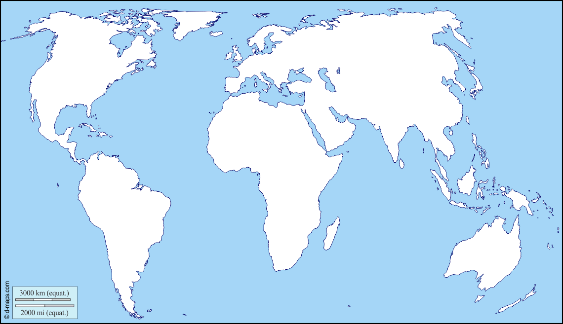
Europe and Africa Centered World Map
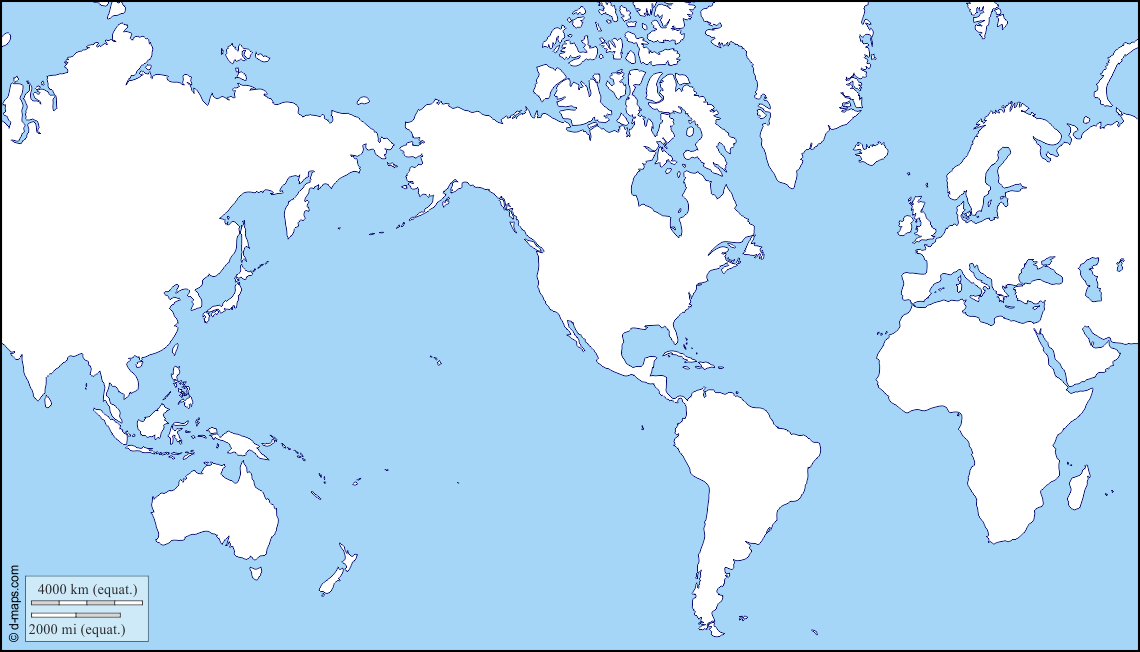
America Centered World Map
|
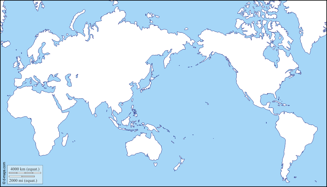
Pacific Centered World Map
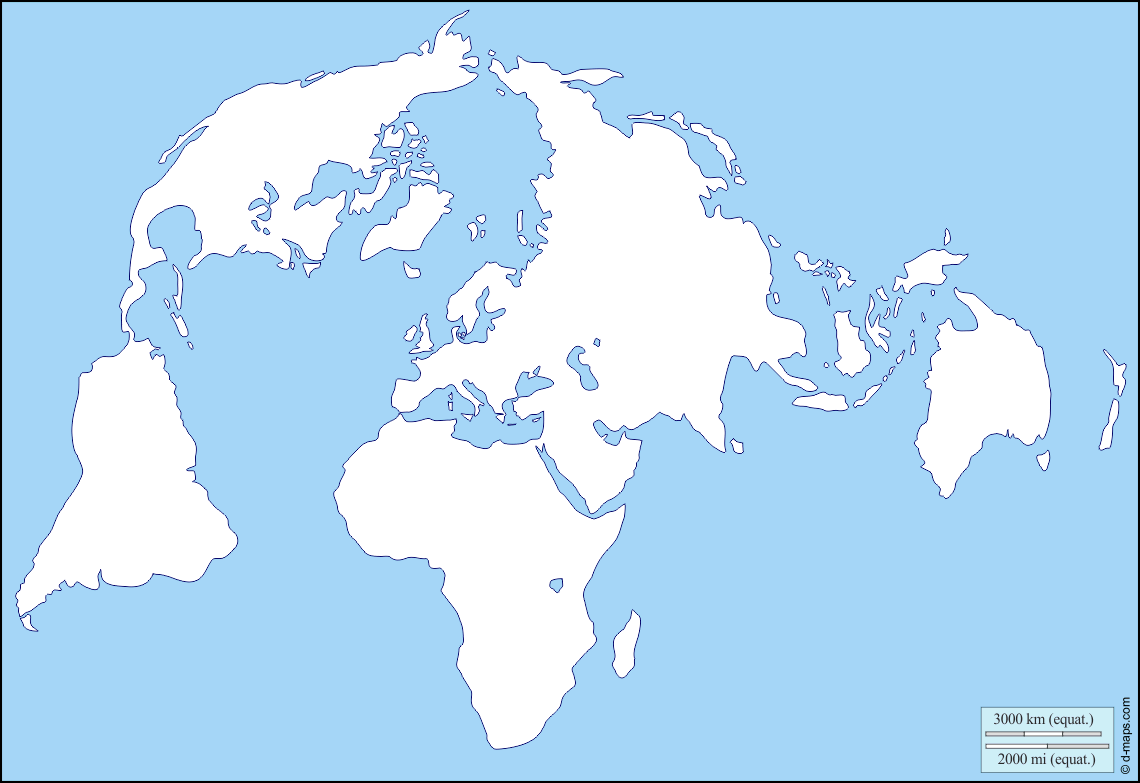
North Pole Centered World Map
|
Source: D-Maps. https://d-maps.com/
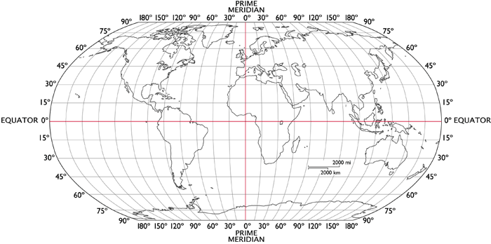
Europe Centered Maps

Generally, world maps are centred on the prime meridian, or zero degrees longitude (east-west), which is located at the Royal Observatory in Greenwich, London. Arguably, this depicts a rather colonial perspective.
It is also because the Pacific Ocean is so large that it easy to 'cut' the map without separating any countries or land masses.
Our meridian-centred view of the world shapes how we refer to world regions, e.g. the 'far east' implies far from Greenwich, London.
It is also because the Pacific Ocean is so large that it easy to 'cut' the map without separating any countries or land masses.
Our meridian-centred view of the world shapes how we refer to world regions, e.g. the 'far east' implies far from Greenwich, London.
|

|
Pacific Centered Maps
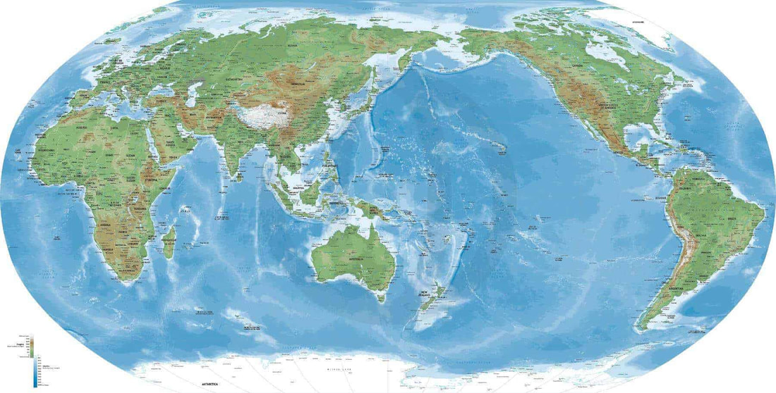
This places Asia, and Australia, in a more prominent position and pushes Europe to the edge. Much of Oceania and Asia uses Pacific-centred maps.
North Pole Centered Maps
|
The United Nations logo design (right) is a map of the world representing an azimuthal equidistant projection centred on the North Pole. The projection of the map extends to 60 degrees south latitude.
|
|
Antarctica Centred Map
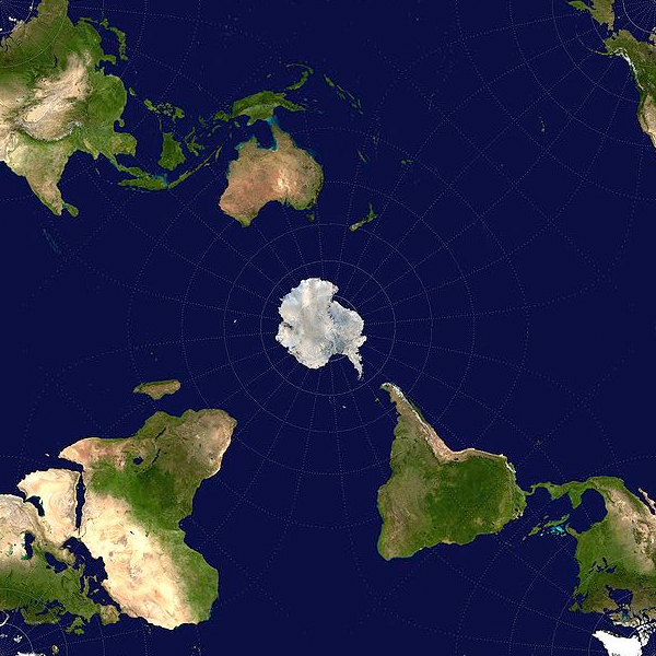
(Matador Network. https://matadornetwork.com/read/map-shows-world-antarctic-point-view/)
