Mapping Conventions: BOLTSS
For every map, check and apply the mapping conventions BOLTSS:
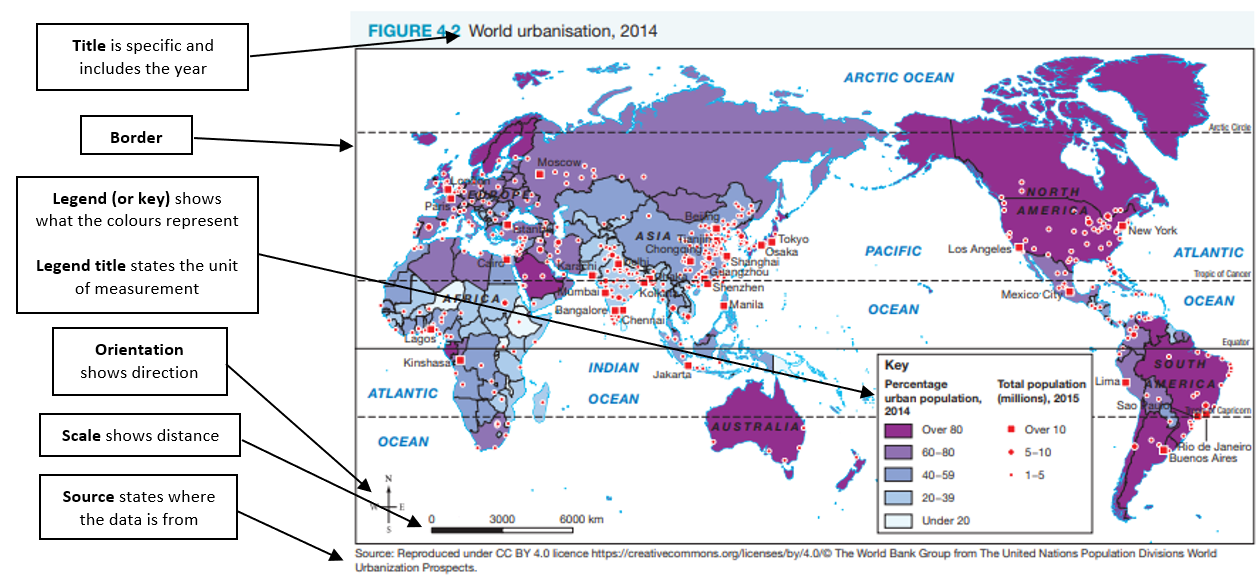
|
Border
|
The border frames the map and assists to define the extent of the map.
To add a border on a map in Microsoft Word, click on the FORMAT tab and click on Picture Border |
|
Orientation
|
Orientation shows direction and location.
Orientation can be shown as either:
|
|
Legend
(or key) and legend title |
The legend explains the colours or symbols used to represent features or objects.
The legend title should:
e.g Average annual rainfall (mm) |
|
Title
|
The title should include where possible:
|
|
Scale
|
Scale represents the relationship between a unit of length on a map and the corresponding length over ground.
Scale should be represented as either:
|
|
Source
|
Where possible the source of the map should be acknowledged.
The source should be where the data is from. When using data from the textbook, the source of the data will be found underneath the table. If not, use the textbook as the source. Format in reports is APA referencing: (author surname or organisation name, year). |
Tips
- Hand-drawn maps should be completed in black ink and pencil.
- Maps used in reports should be referred to as figures and numbered accordingly e.g. Figure 1 …
Example