Photographs
Why do Geographers use photographs?
Geographers use photos as a tool to identify and record geographic features and information.
A photo is an instant visual record that enables you to:
A photo is an instant visual record that enables you to:
- identify the natural and/or built features of a place
- identify patterns of urban and rural development
- identify transport and communication patterns
- analyse specific places at a specific time
- identify changes over time
- make comparisons about change
- study places where field trips are difficult.
Photograph Considerations
Consider the purpose of the photographs and how they provide evidence or support your statements.
When photographs are included in a report they must be referred to in text. E.g. 'Figure 1 shows ...'
Photographs should include:
When photographs are included in a report they must be referred to in text. E.g. 'Figure 1 shows ...'
Photographs should include:
- Annotations where relevant e.g. 'This photograph shows the area through which the proposed Brisbane Airlink will pass. The project will include Australia’s longest road tunnel and a flyover at an estimated cost of $4.6 billion.'
- Mapping conventions (BOLTSS) where possible
- Some indication of scale, e.g. a ruler or object, where applicable. For example, a photo taken at close range to show the scale of sand dune erosion may include a ruler.
Examples
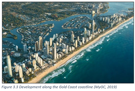
For a report investigating coastal erosion in the Gold Coast, the following photographs could be used:

|

|

|

|
