Area and Grid Referencing
Geographers use grid systems to find and represent the location of places and features.
Relative and Absolute Location
Every feature and place on the Earths surface has a specific location.
The location can be expressed in a number of ways:
The location can be expressed in a number of ways:
- Relative Location: Expressed in terms of its distance from other features or places.
- Absolute Location: The location of a point on the Earth's surface that can be determined by using an alpha-numeric grid; grid and area references; or latitude and longitude. (for information on Latitude and Longitude, go to the page of that name on this website)
Alpha-Numeric References
In an alphanumerical system, map grids are marked by the alphabet along one axis and numbers along the other, in order to provide a coordinate.
Commonly used on world maps and in street directories. (see below)
Commonly used on world maps and in street directories. (see below)

|

|
Area and Grid Referencing
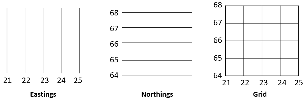
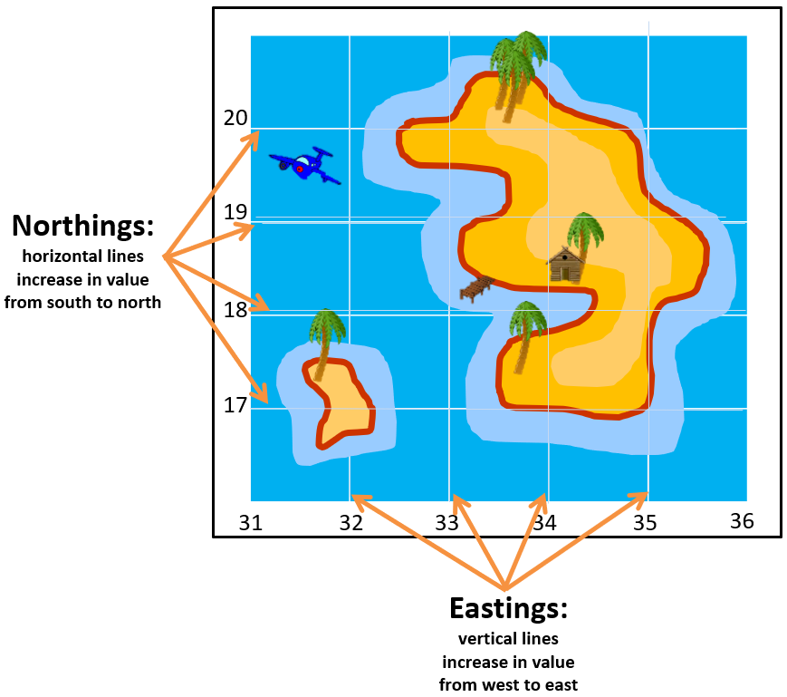
Eastings and Northings

Area References
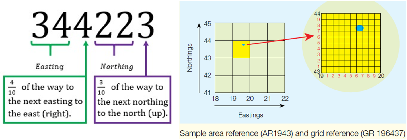
An area reference (AR) is a four-figure map coordinate formed by the intersection of eastings and northings.
Area references are useful for locating large features, such as towns or lakes.
Eastings are read before northings.
Where a feature extends beyond one grid square, the AR should be based on the lower left-hand corner of the square that contains the main part of the feature.
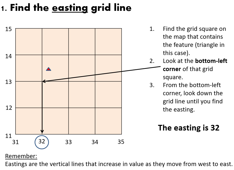
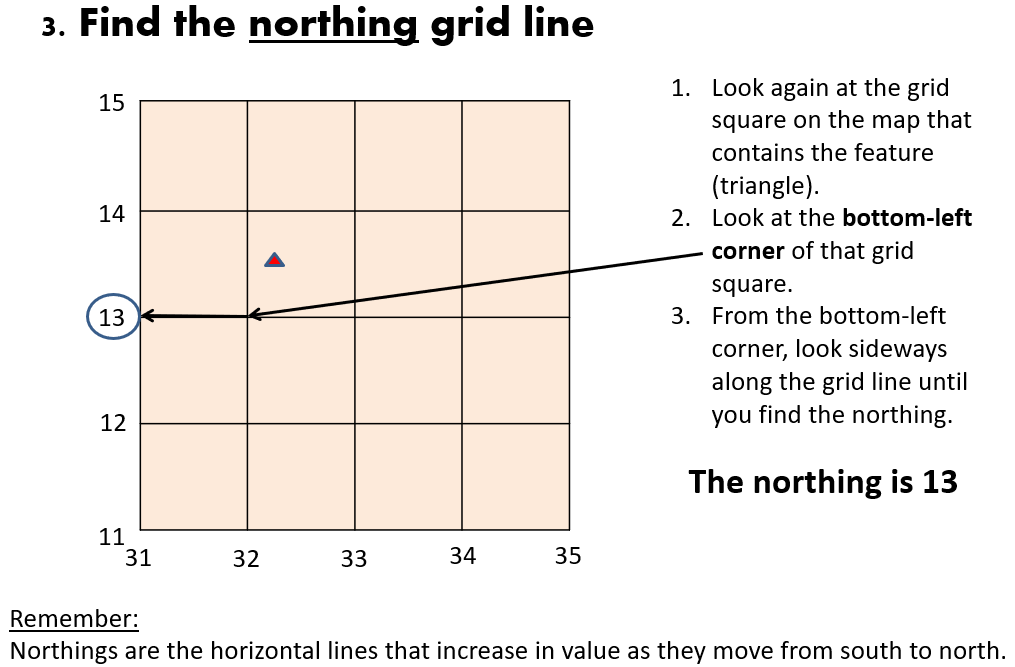
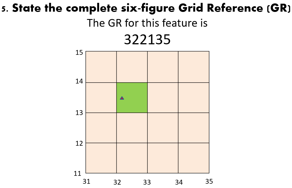
Grid References
A grid reference (GR) is a six figure map coordinate used by geographers to locate smaller features within a grid square on a map such as a building.
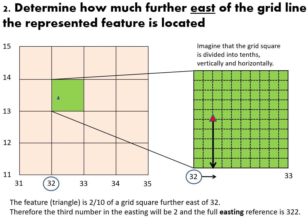
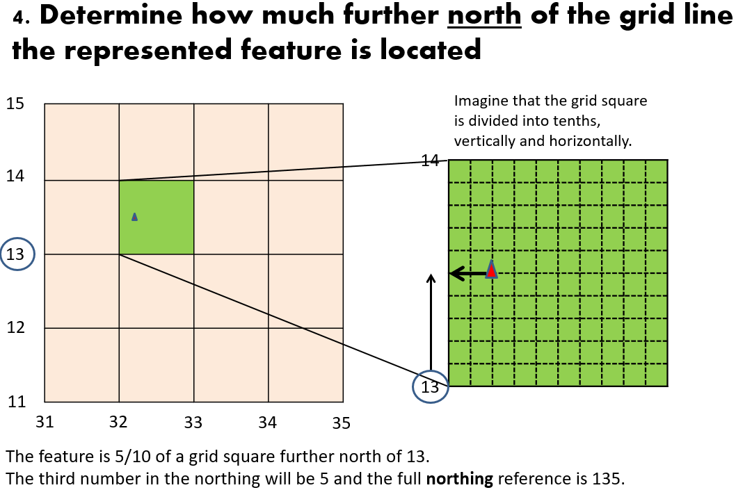
To find these extra numbers, each easting and northing is subdivided into 10 equal parts.
Eastings are read before northings.
A grid reference (GR) is a six figure map coordinate used by geographers to locate smaller features within a grid square on a map such as a building.
To find these extra numbers, each easting and northing is subdivided into 10 equal parts.
Eastings are read before northings.
- The first three digits are the easting. The first two digits refer to the easting grid line, and the third digit is a number between 0 and 9, which indicates at what tenth of a grid square further to the east the point is located.
- The fourth, fifth and sixth digits are the northing. The fourth and fifth digits refer to the northing grid line, and the last digit is a number between 0 and 9, which indicates at what tenth of a grid square further to the north the point is located.
Steps to find the Grid Reference