Scale
To draw a map of any part of the Earth's surface, the area must be reduced in size or scaled down. In other words, maps are actually a scaled-down representation of part of the Earth's surface.
Scale is a ratio of what the distance on the map represents to the distance in the real world. This means the scale can be used to calculate distances and areas.
To determine how large the real area is, it is always necessary for the map to indicate the scale at which it has been drawn.
Scale is expressed as the ration of distances on the map to distances on the ground.
Scale can be expressed in three ways
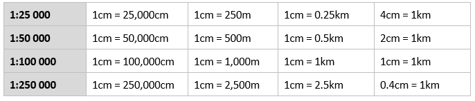
- As a statement (in words) e.g. '1 cm represents 100 000 cm' or '1 cm represents 1 km'
- As a ratio or representative fraction e.g. 1:100 000 or 1/100 000
- As a linear scale (see below)

The most common scales used for topographic maps are below (first grey column):
Large-scale v Small-scale Maps
- Small-scale map: A map featuring a large area, such as an entire country. E.g. scale of 1:100 000
- Large-scale map: A map that shows only a small area of the Earths surface. E.g. scale of 1:20 000
Small-scale maps
A small-scale map shows more area of the Earth, but it is less detailed. The detail is 'small'.
In order to show the entire country, the map must be scaled down until it is much smaller.
E.g. to fit a map of the world onto an A4 paper, the scale would be approximately 1:135 000 000.
Large-scale maps
A large-scale map only shows a small area of the Earth, but it shows more detail. The detail is 'large'.
It is a large-scale map because the area of land being represented by the map has been scaled down less; in other words, the scale is larger.
E.g. to fit a map of Australia onto an A4 paper, the scale would be approximately 1:20 000 000.
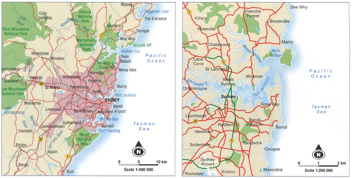
Left Map (Small-scale): Shows more area - of Sydney and its surrounding areas - and is drawn at a scale of 1:400 000
Right Map (Large-scale): Shows less area, but more detail of the Sydney city area and is drawn at a scale of 1:200 000
Right Map (Large-scale): Shows less area, but more detail of the Sydney city area and is drawn at a scale of 1:200 000
Calculating Distance
The distance between two points on a map can be found by measuring the distance on the map and then converting it from centimetres to kilometres and/or metres.
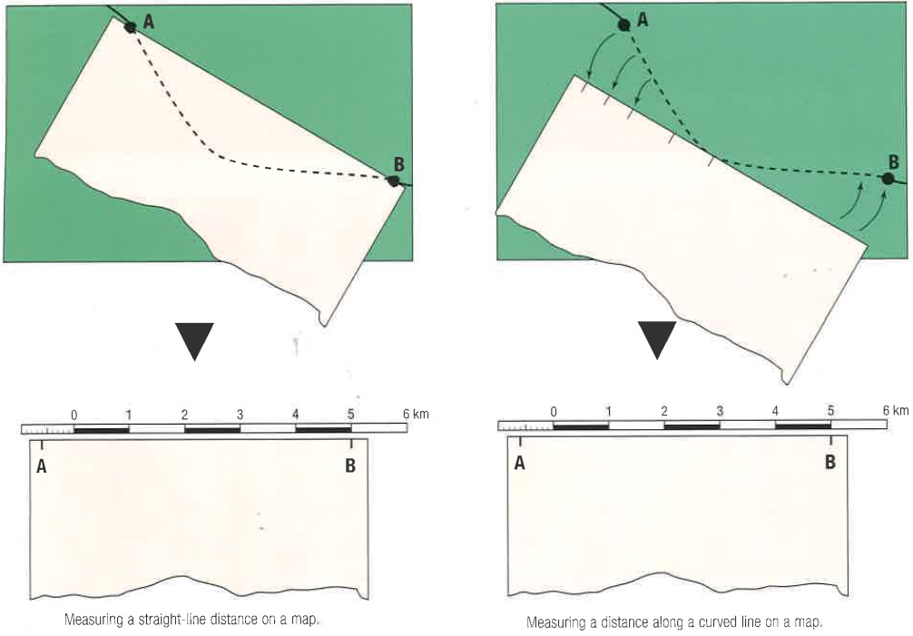
Measuring a distance along a curved line
You could use the following to measure distance between two points:
Measuring a straight-line distance
You could use the following to measure distance between two points:
If using a piece of paper
1. Place the edge of the paper between the two points.
Measuring a distance along a curved line
You could use the following to measure distance between two points:
- string
- a stick
- the edge of a piece of paper
Measuring a straight-line distance
You could use the following to measure distance between two points:
- a ruler
- the edge of a piece of paper
If using a piece of paper
1. Place the edge of the paper between the two points.
- Straight line: Mark on the paper the distance between the points OR
- Curved line: Mark off the starting point and carefully move the paper so that its edge follows the curve, marking each section with a pencil as you go. Then mark the end point.
Information & Figures source: Kleeman, Grant. 2014. Skills in Geography: Australian Curriculum. Cambridge University Press.
