Relief
Relief Introduction
Relief means the shape of the land e.g. whether it is flat, hilly, mountainous etc.
Because maps are usually drawn on flat sheets of paper, it has been necessary for cartographers (map makers) to develop ways of showing what the landscape is like.
Relief is a term geographers use to describe the shape of the land, including its height above sea level (asl) and the steepness of its slopes.
Relief is represented on topographic (physical) maps using contour lines, colours, spot heights and symbols.
Spot Height
A spot height is usually shown as a black spot or triangle with a height written next to it.
It gives the exact elevation (height) about sea level of a particular location or feature.
It gives the exact elevation (height) about sea level of a particular location or feature.

Contour Lines
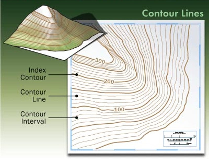
Contour lines are used to represent the connection of a series of points of equal elevation (height above sea level).
The lines provide geographers with information about the
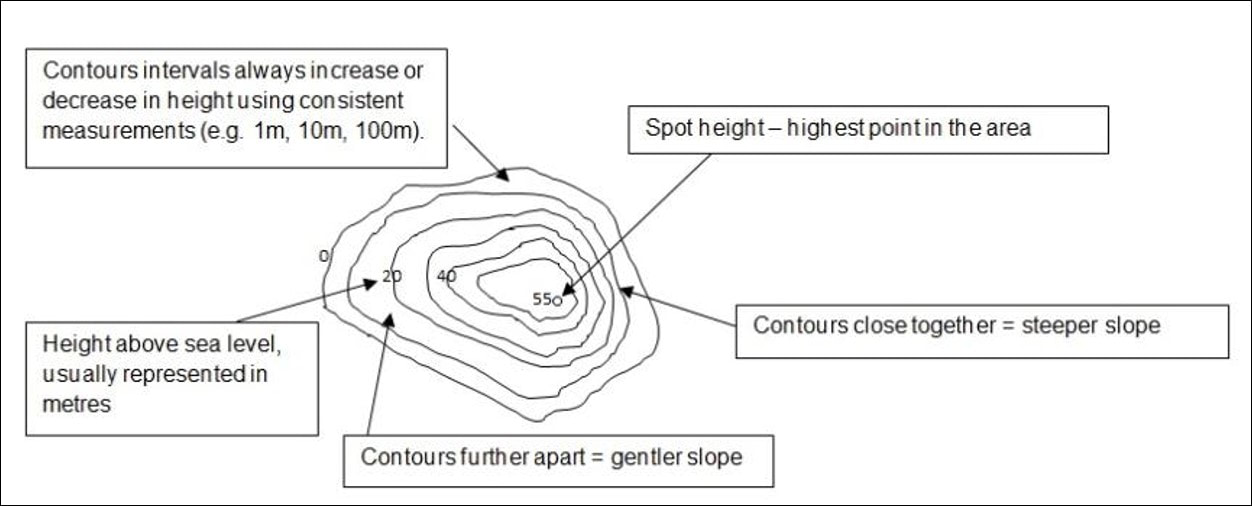
Every point along a contour line has the same value e.g. 20m asl.
Spacing of Contour Lines
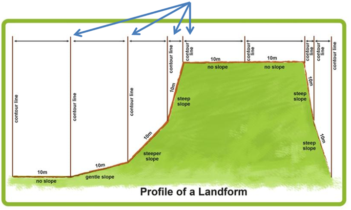
The spacing of contour lines on a map indicate the steepenes of slopes.
The lines provide geographers with information about the
- Shape of the land
- Slope of the land
- Height of features above sea level (asl)
Every point along a contour line has the same value e.g. 20m asl.
Spacing of Contour Lines
The spacing of contour lines on a map indicate the steepenes of slopes.
- Contour lines close together = steep slopes (because the height goes up quickly over a short area)
- Contour lines far apart (or widely spaced) = flatter areas or gradual slopes.
Contour Interval (CI)
The contour interval is the difference in height between two adjacent contour lines.
It is always constant on a particular map.
Sometimes, the elevation of contours is not shown on every contour line, because this may make the map difficult to read. Elevation is sometimes labelled on every second or fifth line.
A Depression
A depression e.g. hole, has contour lines with heights getting lower instead of higher. These contour lines have small marks on them pointing towards the middle.
A depression e.g. hole, has contour lines with heights getting lower instead of higher. These contour lines have small marks on them pointing towards the middle.

|

|
Marine Contours
Contour lines also exist below sea level – these are referred to as marine contours.
Contour lines also exist below sea level – these are referred to as marine contours.
Summary
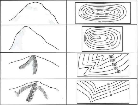
Contour Lines and Landforms