Strands and Standard Elaborations
Geography is organised into 2 interrelated strands:
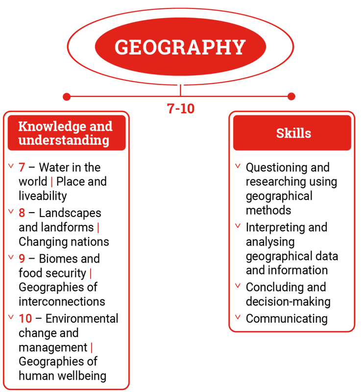
Geography is presented in year levels for Knowledge and understanding content and in bands for Skills content from Year 7 to Year 10. The 2 strands are interrelated and should be programmed and taught in an integrated way. The content descriptions of the 2 strands have been written so that this integration is possible at each year.
Under each strand, curriculum content is further organised into sub-strands.
- Knowledge and understanding
- Skills.
Geography is presented in year levels for Knowledge and understanding content and in bands for Skills content from Year 7 to Year 10. The 2 strands are interrelated and should be programmed and taught in an integrated way. The content descriptions of the 2 strands have been written so that this integration is possible at each year.
Under each strand, curriculum content is further organised into sub-strands.
(https://v9.australiancurriculum.edu.au/teacher-resources/understand-this-learning-area/humanities-and-social-sciences#geography-7%E2%80%9310)
Knowledge and Understanding Strand
At each year level, the content in the Knowledge and understanding strand is organised under 2 sub-strands, which form the 2 topics to be studied in that year.
Geographical knowledge refers to the facts, generalisations, principles, theories and models developed in Geography. This knowledge is dynamic and its interpretation can be contested, with opinions and conclusions supported by evidence and logical argument.
Geographical understanding is the ability to see the relationships between aspects of knowledge and to construct explanatory frameworks to illustrate these relationships. It is also the ability to apply this knowledge to new situations or to solve new problems.
Skills Strand
Geographical skills are the methods that geographers use in their investigations of geographical phenomena and challenges. These skills involve the use of primary research, including fieldwork, and secondary research materials.
Key skills include asking questions, using geographical methods, recording and representing data and information, using geospatial technologies and digital technologies, interpreting and analysing data and information, evaluating and decision-making, proposing strategies or responses, and communicating conclusions.
This strand is organised in 2-year bands under 4 sub-strands:
Questioning and researching using geographical methods
Students develop and modify questions, and collect, organise and compare geographical data and information from primary research methods, including fieldwork, and secondary research materials. They record and represent geographical data and information in a range of formats.
Interpreting and analysing geographical data and information
Students explain patterns and trends in data and information, make generalisations and predictions, and infer relationships.
Concluding and decision-making
Students evaluate data and information to draw and justify conclusions about the impact of the geographical challenge or phenomenon. They develop and decide on a strategy, taking account of environmental, economic, social or other criteria, and predict outcomes and impacts.
Communicating
Students create descriptions, explanations and responses, using geographical knowledge and methods, geographical tools as appropriate, and concepts and terms that incorporate and acknowledge research findings.
